
GIS Mapping
JC Petroleum’s GIS mapping department can provide you with:
- Leasehold and ownership maps
- Parcel mapping services
- Field data collection maps
- Area and satellite imagery maps
- Well location maps
- Map-database integration
JCP has a vast array of geospatial tools at our disposal. JCP’s GIS mapping department creates a virtually limitless array of map types to help you visualize information and make informed decisions.
JCP has made a considerable investment in mapping software, hardware and expertise to enhance the overall land services process.
We can supply your organization with maps in any format you desire, whether from a variety of digital formats or on paper, in sizes up to 42" high with unlimited width.
JC Petroleum’s GIS mapping department has constant access to up-to-date geographic information from a variety of sources, including official governmental survey boundaries, assessment information, water body and road locations, field-collected ownership data and more. With a vast array of geospatial tools at our disposal, our GIS mapping department creates a virtually limitless array of map types to help you visualize information and make informed decisions. We have made a considerable investment in mapping software, hardware and expertise so you can benefit. We can supply your organization with maps in any format you desire, whether from a variety of digital formats or on paper, in sizes up to 42" high with unlimited width.
Some of the many map types we create include:
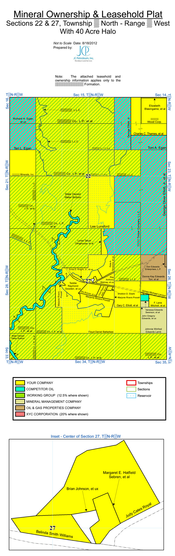
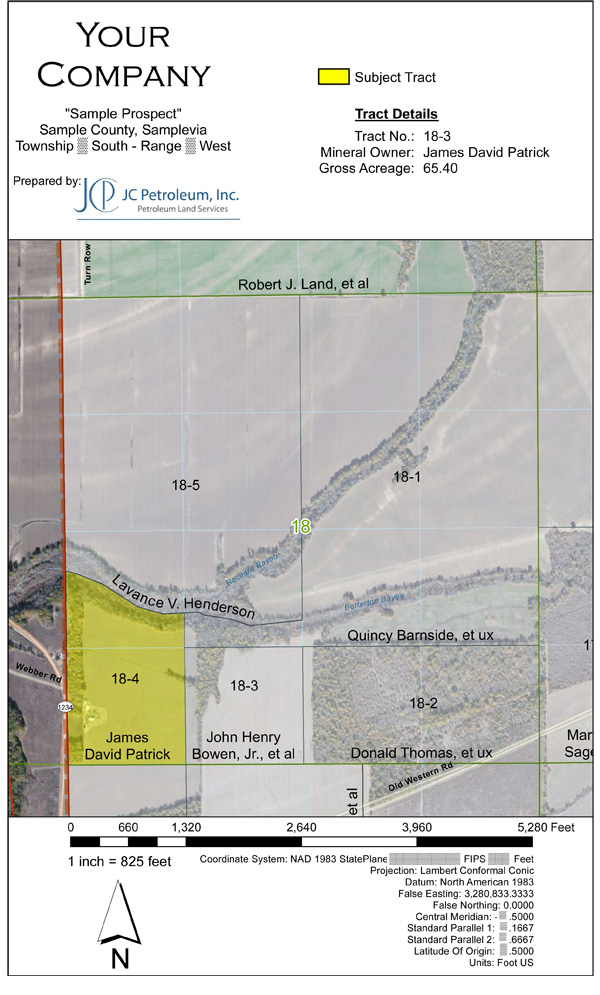
- Ownership and Leasehold - see how your own leasehold and your competitors relate to each other, unleased acreage, and production
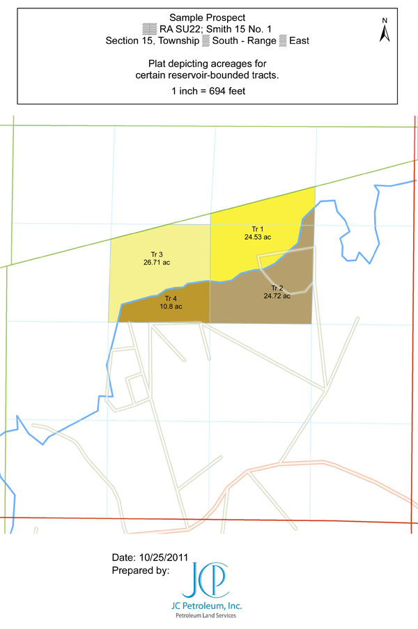
- Acreage Split Calculations - determine how much of a tract's acreage exists on either side, or under, an irregular feature like a road, river, bayou, or lake with near-survey precision
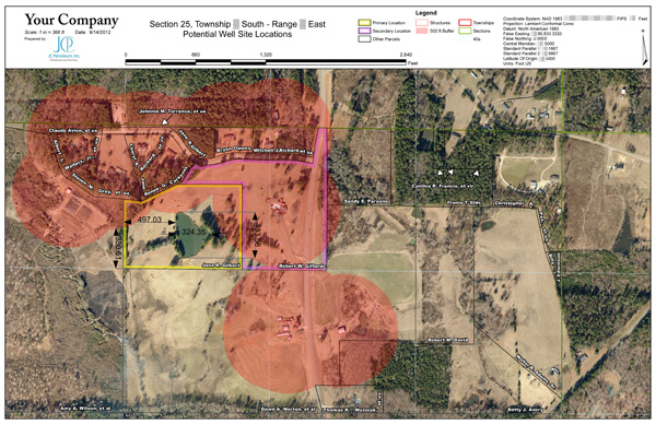
- Prospective Well Locations - quickly account for the proximity of structures, transportation, utilities, water, surface restrictions, and other features to locate suitable well sites
- Lease Purchase Report Plats - include reference plats identifying the specific tract or tracts leased with your Purchase Reports
- Pipeline and right of way plats
- Feature Identification - identify rights of way, fence lines, poles, towers, and other features and their proximity to tracts and well sites
If there is data available and we can get it, WE CAN MAP IT!
